|
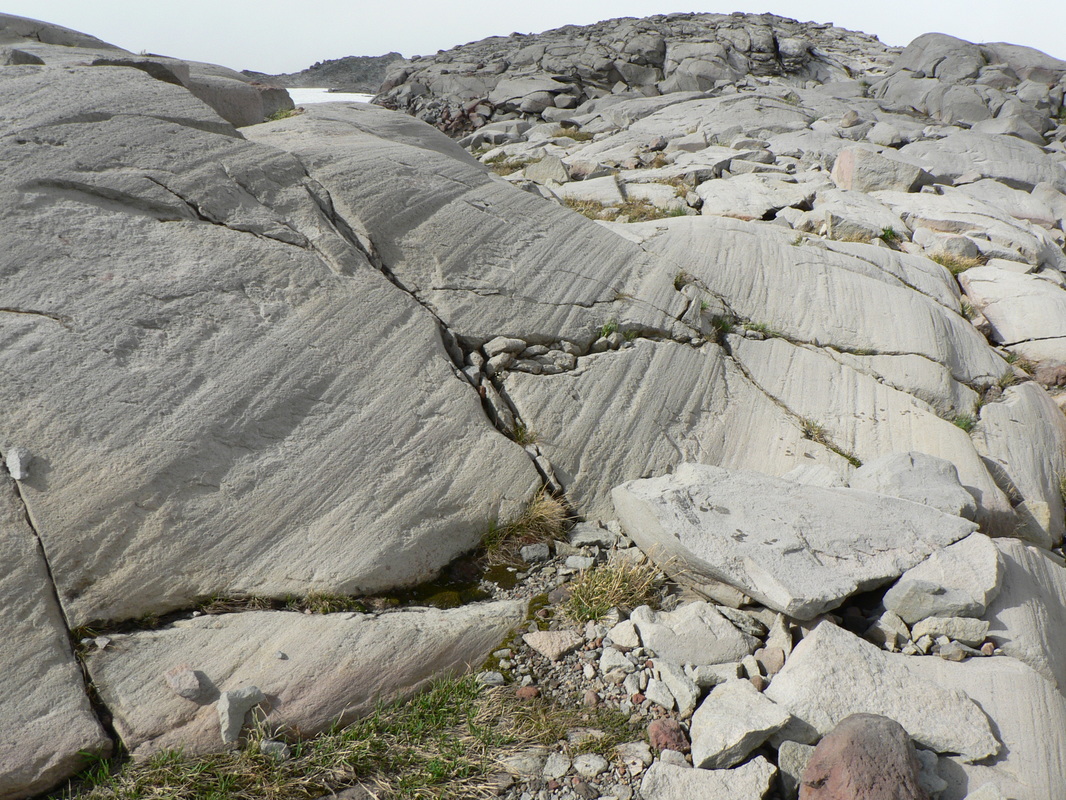
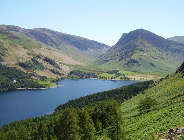
Starter To get students thinking, show a photo of a glaciated landscape and ask them to guess how the landscape was shaped. Or, this Landscape image interpretation task powerpoint presentation from the Royal Geographical Society's lesson plan How glaciers shape the land and what they leave behind is a really good way to get students thinking about the landforms. The PPT covers landforms formed by erosion and deposition, so it could be adapted if the two processes were being covered in separate lessons. I would clarify to students that a glacial landscape is one which is still has a glacier, whereas a glaciated landscape once had glaciers but they no longer exist, only the landforms that they created are left. Main activities I would make sure students remember the difference between weathering (break down of rock in situ) and erosion (removal of rock). Students watch this BBC video Highland landforms - before and after glaciation, which clearly demonstrates the effect of the glacier on the landscape. Now students understand the impact of glaciers on the landscape, ask them if they remember any different types of weathering and how these might be used in a glacier. This video has a nice visual of how abrasion and plucking work, so I would just show that brief clip from the video. Students could then use the Glaciers online photoglossary, available here, to write a brief explanation or description for each of the formations. They could then label blank diagrams based on these examples on the BBC Bitesize page Landscapes of glacial erosion on an OS map or the diagram below, taken from this video. Students could then be assigned a feature to work on individually or in a group and produce a poster with a description of the feature, an explanation of how it was formed, a photograph of a named located example and a sketch of the feature. To differentiate the task, some students could be given key words that they have to include and the teacher can bear the students' abilities in mind when assigning features. 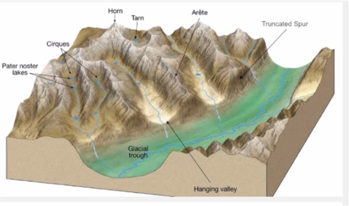 Plenary
Put up a photo of a glaciated area of the UK, e.g. Highlands, Snowdonia, Lake District. Ask students how we can tell that there used to be glaciers there. Or a quick quiz using a slideshow of example photos, students work in groups to name the feature and get points for each correct answer. For an example selection of photos, see the subject knowledge page for this topic. Homework/Project Students could build a 3D model of a specific erosional feature or of a wider glaciated landscape, for example out of plasticine. These BBC bitesize videos are also very useful: Lochaber - High level glaciated landscape - http://www.bbc.co.uk/education/clips/zf46n39 Lochaber - Glaciated valley landscape - http://www.bbc.co.uk/education/clips/zrqygk7
0 Comments
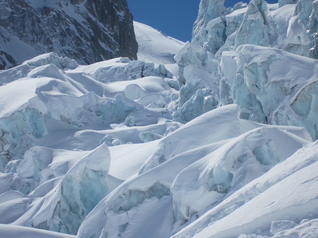
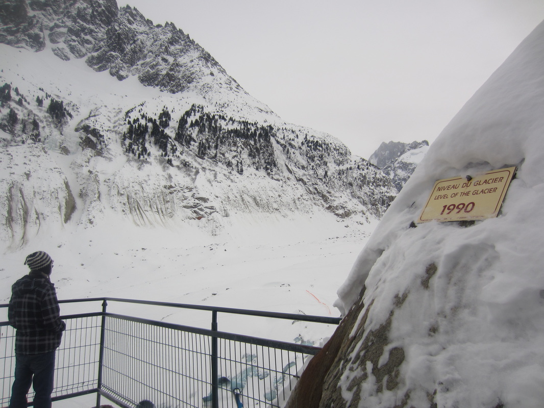
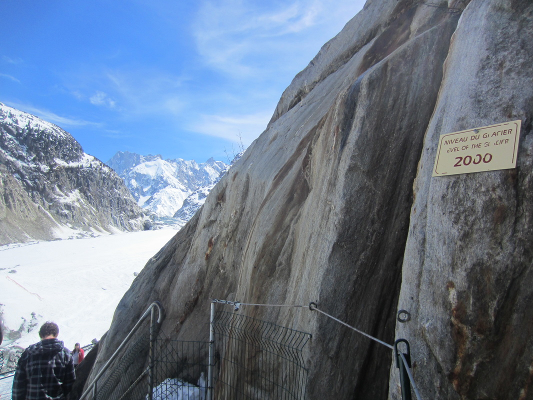
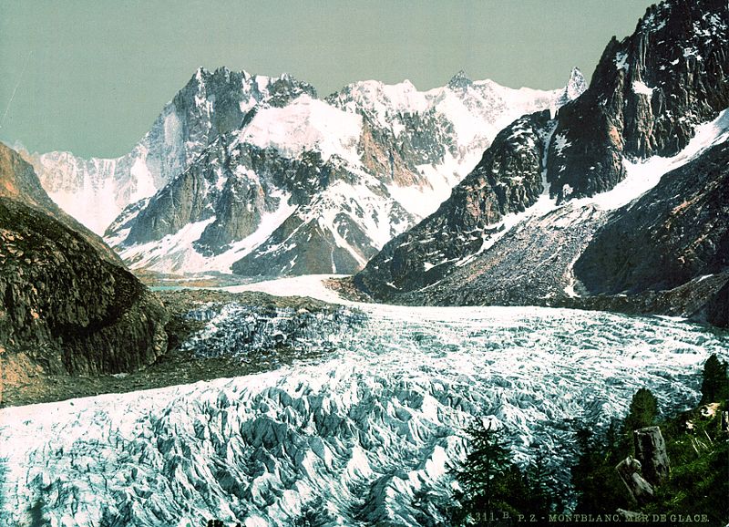
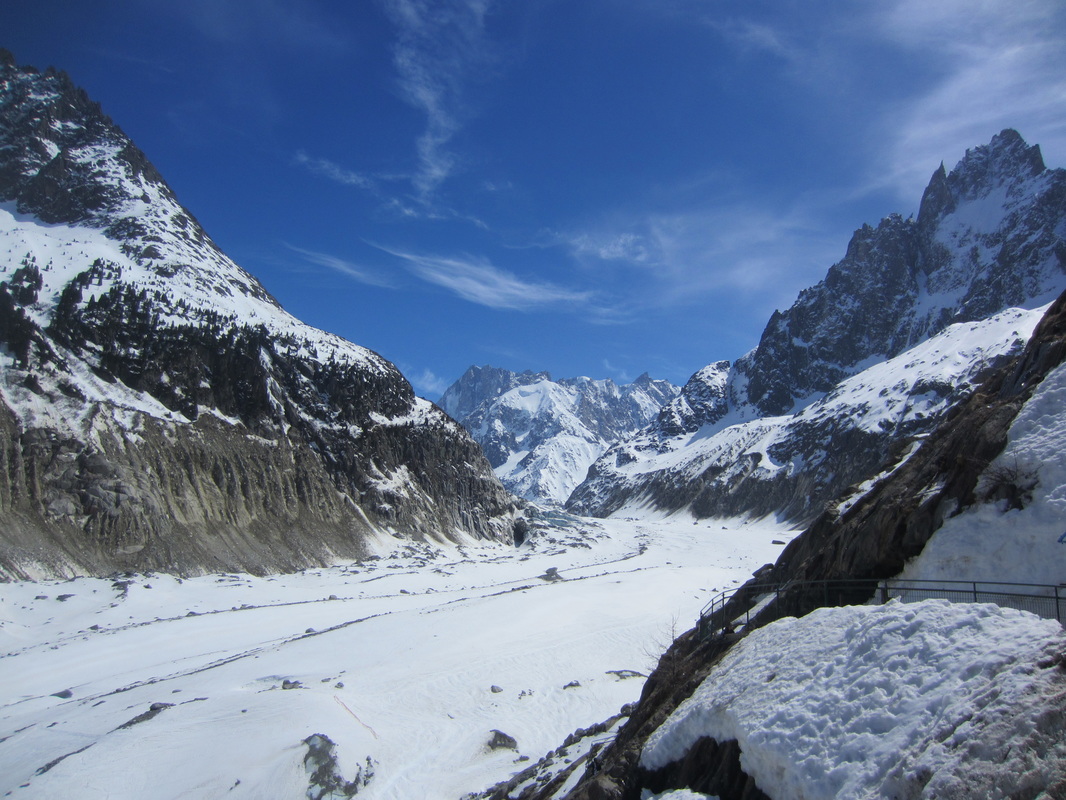
I would start the topic with a lesson to set the context, introduce the topic and check what students already know about glaciers. Starter To get students quiet and thinking about the topic, I would put this riddle on the board and give them a few minutes to discuss what the answer could be: I cove 10% of the Earth's land, sometimes 2 miles thick. And I'm also in your Coke when you take a sip. I so heavy I cause dents in the surface here and there. Yet I started life as a snowflake, light as air. The answer is ice. Then I would ask students to guess the topic of glaciers using clues. These could be photos such as those below, as well as the sound of a creaking moving glacier playing in this BBC video playing in the background. As a class we create a mindmap of what they already know about glaciers. Main activities I would start by asking students when they think the last ice age was, how cold it was in the UK then and if they could survive it? The answer is that technically we are living in an ice age now! It's called the Pliocene-Quaternary glaciation and started about 2.58 million years ago. It's just that we're living in a warmer period of an ice age called an interglacial period. What we usually think of as an ice age is a cooler period called a glacial period and the last one ended 10,000 years ago. Ask students where we can find glaciers in the world? (Antarctica, Himalayas, Switzerland, Greenland, Iceland, Norway, New Zealand, USA, Canada are just a few examples, a full list can be found on wikipedia.) Atlases could be used for this stage. Photos of these glaciers could be shown so students understand what a glacier looks like. Ask students if there are any glaciers in the UK? (No) Were there any in the past? (Yes) How do we know that? (the landscapes that they formed can still be seen today) Having looked at the location of current day glaciers, ask students what conditions are needed for glaciers to form? (year round low temperatures, snow fall) Students then watch the BBC video The formation, flow and retreat of glaciers. While watching students take notes and after label a diagram. Alternatively, we could brainstorm words to describe the formation, flow and appearance of glaciers, before students write a paragraph describing the process. For weaker students they could do a gap fill instead or use a writing frame. Although glacial budgets isn't part of the specifications for AQA or Edexcel A, the two exam boards which cover glaciation, I would check students' understanding. I would show them my photos from the Mer de Glace glacier in Chamonix-Mont-Blanc in France showing the rapid change in the size of the glacier. I would ask them what they think caused this. To clarify, I would ask what happens when more snow falls at the top of a glacier than melts at the bottom? (positive glacial budget, glacier advances)
What if less snow falls and more snow melts? (negative glacial budget, glacier retreats and shrinks) Are most of the world's glaciers advancing or retreating? (retreating) Why do you think that is? (global warming) Plenary Students write definitions for some of the key words from the lesson, such as glacier, retreat, advance, glacial period, interglacial period. Homework Students could research a current day glacier, with info such as location, size, age, movement, human uses. |
AuthorMy name is Heather and I am going to begin my SCITT course to train as a Geography teacher. ArchivesCategories
All
|
 RSS Feed
